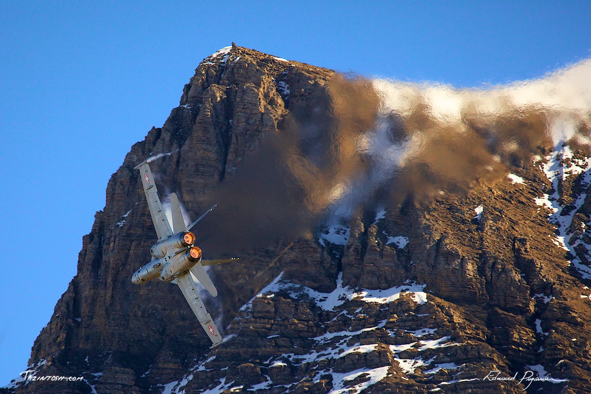
Axalp is not an easy task! You'll need to climb a impressive topography carrying your gear before benefit of it. It's a challenging event, as well for the physical part as for the technical aspect of the photography. Anyway, it's an extraordinary moment you'll discover. The landscapes and show makes an unforgettable experience.Every year, in late-autumn, the Swiss Air Force demonstrates the professionalism of its pilots in Axalp/Ebenfluh in the Swiss Alps 2200 meters above sea level, on top of a mountain, a spectacular air show is put on, which is open to the public. From the highest vantage point, planes fly in front of the spectator and a shoooting demonstration to rival any shown across Europe or indeed the world, is performed for all to see.
Some statistics:
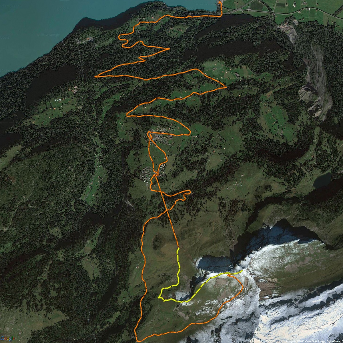
Yellow section (the “true” climb):
- Total distance: 2.79 km
- Total duration: 1h 38m 25s
- Average speed: 1.70 km/h
- Maximum speed: 5.49 km/h
- Average elevation: 2060 m
- Minimum elevation: 1920 m
- Maximum elevation: 2230 m
- Distance climbed: 440.19 m
- Distance descended: 139.50 m
- Average climbing gradient: 18°
- Maximum climbing gradient: 66°
- Average descending gradient: -19°
- Maximum descending gradient: -76°
Day total (without bus):
- Total distance: 12.11 km
- Total duration: 11h 38m 40s
- Average speed: 1.04 km/h
- Maximum speed: 7.15 km/h
- Average elevation: 1970 m
- Minimum elevation: 1470 m
- Maximum elevation: 2230 m
- Distance climbed: 1080 m
- Distance descended: 1080 m
- Average climbing gradient: 52°
- Maximum climbing gradient: 90°
- Average descending gradient: -44°
- Maximum descending gradient: -90°